2014 Napa surface rupture (Trexler, 2014)
|
High-Resolution Topographic Models & Earthquake Response
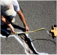
In the wake of the 24 August 2014 Mw 6.0 South Napa earthquake, I have been working with collaborators at UC Davis (both in the Department of Earth & Planetary Sciences and the KeckCAVES group) to develop and streamline a workflow for rapid scientific response to surface-rupturing earthquakes. In particular, we are focused on capturing and preserving otherwise ephemeral offset features: natural features that record details of fault slip degrade considerably within months of a rupture, which human-made features are often repaired within hours to days. As a result, measurements taken immediately after a rupture are often not reproducible, and thus do not allow for (1) repeat measurements to constrain uncertainty or (2) subsequent occupations of sites to capture post-seismic response such as afterslip.
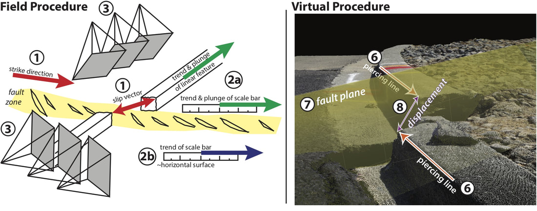
We have also developed a rapidly deployable field workflow using low cost structure-from-motion (SfM) photogrammetry and 3D virtual reality to enable archiving and assessment of primary, field-measured fault offset data. This work was recently published in Geophysical Research Letters. |
|
Methods for structure-from-motion capture of earthquake surface rupture. From Trexler et al. (2018, GRL)
